Real-Time Public Transport And Wayfinding Digital Signs Reduce Confusion For London Travellers
Whilst Londons continued popularity as one of the greatest cities on the globe for people to live, raise a family and work continues to attract a significant influx, the capital is a victim of its own success. With a population currently topping 8.8 million and predicted to surge by 10% to 9.5 million by 2026, recent data shows London is Europes’ second most congested city (behind Moscow). Our Capital faces huge and growing pressure on its infrastructure to keep the city moving.
Private car usage is Londons leading cause of congestion, pollution and frustration, accounting for nearly 40% of all journeys, with around 30% of these being for less than 2KM. However, bold efforts are afoot from both public and commercial operators encouraging people to ditch their cars. Alongside Transport for London’s omnipresent bus, bike, train, tram, tube and boat options there are numerous eBikes, Car-share, Ride-Hailing and coming soon eScooter operators, vying to commercialise mass transit.
Current modus operandi, from most (if not all) of the current commercial operators, such as Uber, Lyft, Mobike and Ofo is to require customers to download their associated app to check availability, pay and book a journey. Alongside this silo-based approach there are also apps such as CityMapper that provide aggregated services showing local availability, but of course, you are still required to download it. This, in itself, requires an awareness that the app exists. For public transport, the traditional method of printed timetables is now largely superseded by the use of web-based tracking/planning and apps. Indeed Transport for London has had a longstanding policy of open data to support developers in their drive to improve the visibility of their services.
What this informational complexity means for citizens, visitors and tourists is that they are subject to a restricted view on what smart mobility options are available to them; Where are the bus stops? When is the next bus, train, tram or boat? Are there any travel alerts? How many bikes are available, are there any shared rides leaving soon? How many ride-hailing vehicles are available locally or is it easier to just walk? All too often, simply because people aren’t aware a transit option exists, they revert to their car.
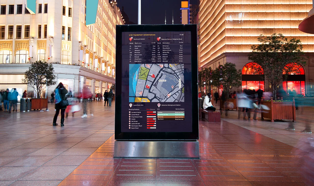
PassageWay real-time public transport and wayfinding digital signs solve this problem by transforming any Internet-connected screen into a local wayfinding point, displaying all the nearby smart mobility options in real-time alongside mapping information. PassageWay signs display local data to within a few meters of any location and currently, real-time TfL data for the entirety of Londons’ network.
The platform has evolved from software developed for Transport for London, the worlds’ largest integrated transport network, to power digital screens across their network.
Suitable for virtually any sized screen with a broadband Internet connection running a modern browser, PassageWay automatically updates 24/7 with no human intervention, displaying real-time data for the local public transport options chosen for the precise location. Passageway real-time public transport and wayfinding digital signs provide a simple, robust solution to encourage the use of sustainable, commercial and public transport.

